
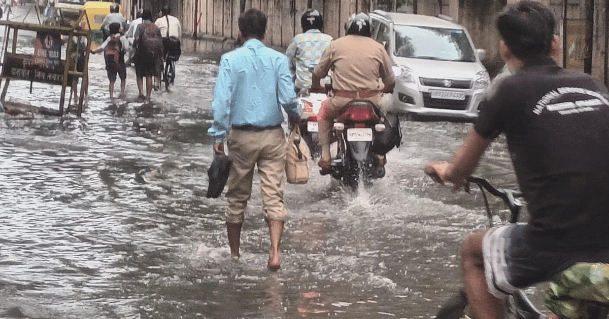
UP Weather Update: Due to the activity of monsoon in Uttar Pradesh, changes in the weather are continuing. There was intermittent rain at many places in the state during the last 24 hours. Its effect was visible in the weather. The sky is cloudy even on Wednesday morning. The Meteorological Department has predicted the possibility of rain and lightning in the state on Wednesday. However, there is no alert of torrential rain anywhere. Now the temperature will gradually increase.
Weather condition in UP on 13 September
According to Zonal Meteorological Centre, Lucknow, there may be rain and thundershowers at some places in the state on September 13. Along with this, there is a possibility of lightning. In the capital Lucknow and surrounding areas, the maximum temperature on Wednesday is expected to be 32 degrees Celsius and the minimum temperature will be 26 degrees Celsius.
Chances of rain in these districts
In Uttar Pradesh, an alert is issued for heavy rain in Kaushambi, Fatehpur, Pratapgarh and its surrounding areas. There are chances of rain in Sonbhadra, Chandauli, Ghazipur, Varanasi, Mirzapur, Sant Ravidas Nagar, Jaunpur, Prayagraj, Kaushambi, Chitrakoot, Banda and Mahoba districts. Along with this, there is a possibility of rain in Ballia, Mau, Deoria, Azamgarh, Gorakhpur, Sant Kabirnagar, Azamgarh, Basti, Sultanpur, Gonda, Ayodhya, Amethi, Pratapgarh, Barabanki, Lucknow, Rae Bareli, Unnao and Fatehpur.
Along with this, there is a possibility of thunder and lightning in Banda, Chitrakoot, Kaushambi, Prayagraj, Fatehpur, Pratapgarh, Sonbhadra, Mirzapur, Varanasi and Sant Ravidas Nagar. Whereas rain is expected in Moradabad, Amroha, Bijnor, Meerut, Muzaffarnagar, Shamli, Saharanpur, Shahjahanpur, Hardoi, Kannauj, Mainpuri, Etawah, Auraiya, Kanpur Dehat, Kanpur Nagar, Jalaun, Jhansi and Lalitpur. It may also rain in Hamirpur, Rampur, Pilibhit, Bareilly, Lakhimpur Kheri, Sitapur, Bahraich, Shravasti, Kushinagar, Maharajganj, Siddharthnagar and Balrampur districts.
possibility of lightning
Apart from this, there is a possibility of thunder and lightning in Rampur, Bareilly, Pilibhit, Jalaun, Hamirpur, Mahoba, Jhansi, Lalitpur and its surrounding areas. At the same time, lightning is also expected in Jaunpur, Ghazipur, Lakhimpur Kheri, Kanpur Dehat, Kanpur Nagar, Unnao, Lucknow, Barabanki, Rae Bareli and Amethi districts. Also, there are chances of thunder and lightning in Sultanpur, Agra, Firozabad, Mainpuri, Etawah, Auraiya, Bijnor and Moradabad.
Rainy season till 18th September
According to meteorologists, after this, there may be rain and thundershowers at some places in Western Uttar Pradesh and many places in Eastern Uttar Pradesh on 14, 15 and 16 September. There is also a possibility of celestial glow. After this, on September 17 and 18, there are chances of rain and thundershowers at one or two places in Western Uttar Pradesh and at some places in Eastern Uttar Pradesh.
Increase in temperature in the next 24 hours
There is a possibility of a gradual increase of two to three degrees Celsius in the maximum temperature in the state in the next 24 hours. There is no possibility of any major change after this. There is a possibility of a gradual increase of 2 degrees Celsius in the minimum temperature for the next two days. There is no possibility of any major change after this.
Monsoon trough position
According to the latest weather activities, the East West Trough is now ranging from cyclonic circulation over South West Uttar Pradesh and surrounding areas to cyclonic circulation over central parts of the Bay of Bengal and adjoining North Bay of Bengal, South East Uttar Pradesh, Jharkhand, North Orissa. Is going on till. It extends up to 3.1 kilometers above sea level. Along with this, the monsoon trough at mean sea level is now moving towards south-east till East Central Bay of Bengal through Jaisalmer, Shivpuri, Ranchi, Digha. The cyclonic circulation over northwest Madhya Pradesh and adjoining areas is now situated over southwest Uttar Pradesh and adjoining areas and extends up to 7.6 km above sea level.
The weather of UP will be affected
Whereas a cyclonic circulation is located over the central parts of the Bay of Bengal and the adjacent North Bay of Bengal. Under its influence, a low pressure area is likely to form over northwest and adjacent West Central Bay of Bengal during the next 24 hours. After this, it is likely to become more marked and move west-northwestwards along South Odisha and North Andhra Pradesh coast. The effect of these weather activities can be seen in the temperature of the state.