
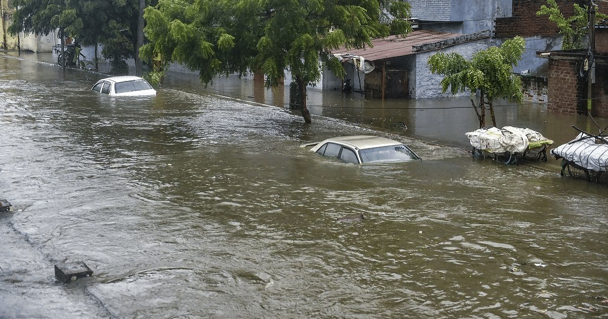
UP Weather Update: The weather has completely changed in Uttar Pradesh due to heavy rain since Sunday night. Rain is continuing in most parts of the state including Lucknow since Sunday night. The lightning kept flashing the whole night. Even on Monday morning the clouds are not showing signs of stopping. Due to dark clouds in the sky, it feels like night in the morning. Many areas have been completely submerged.
Chances of rain till September 16
Due to this change in weather, people are getting relief from the heat. Along with this, a drop in temperature has also been recorded. At present, the Meteorological Department has expected the rain to continue till September 16.
Life affected due to heavy rain in Lucknow
According to the Zonal Meteorological Centre, Lucknow, along with heavy rain in the morning on Monday, there is a possibility of lightning along with thunder at one or two places at night. During this period, there are chances of heavy to very heavy rain at one or two places in Western UP and heavy rain at one or two places in Purvanchal. The Meteorological Department has also issued a warning in this regard.
Minimum temperature expected to be 25 degrees Celsius in and around Lucknow
In the capital Lucknow and surrounding areas, the maximum temperature is likely to be 31 degrees and the minimum temperature will be 25 degrees Celsius. Due to rain, the humidity level in the season has reached 96 percent.
Chances of rain till September 16
According to the Zonal Meteorological Centre, after this, there is a possibility of lightning along with thunder at one or two places in entire Uttar Pradesh on 12, 13 and 14 September. During this period, there may be rain and thundershowers at some places in Western UP and at many places in Eastern UP. After this, on September 15, there is a possibility of rain at one or two places in Western Uttar Pradesh and some places in Purvanchal. Similar weather will be seen in the state on September 16 also. There may be thunderstorms and showers.
Maximum temperature will now increase
According to the latest weather conditions, there is no possibility of any major change in the maximum temperature in the state during the next 24 hours. After this, a gradual increase of two to three degrees Celsius can be recorded during the next two days. There is no possibility of any major change in the minimum temperature during the next four days.
Monsoon trough passing through here
At present the monsoon trough at mean sea level is now moving east-southeastwards through Jaisalmer, Kota, Sidhi, Jamshedpur, Digha till the North-Eastern Bay of Bengal. Along with this, the cyclonic circulation over North-West Madhya Pradesh and adjoining North-East Rajasthan extends up to 7.6 kilometers above the mean sea level. At the same time, a trough runs from northwest Madhya Pradesh and adjacent northeast Rajasthan through eastern Madhya Pradesh to southern Chhattisgarh due to cyclonic circulation and extends up to 4.5 kilometers above sea level. The effect of these monsoon activities can also be seen in the temperature of the state.