
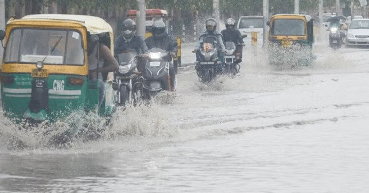
UP Weather Update: Before the end of Sawan, the monsoon is once again showing its effect in UP. Rain continues in most parts of the state. Normal life has been affected due to heavy rains in many places. In many districts including the capital Lucknow, there was heavy rain late on Thursday night.
This week of August has proved to be good in terms of rain. The areas of Uttar Pradesh which were struggling with lack of rain, there has also been an increase in rain during this period. According to the Zonal Meteorological Center, Lucknow, at present the monsoon trough is in the right direction and there is convergence of easterly and westerly winds over the state. Because of this, the rainy season continues.
According to meteorologists, on August 25, there may be rain and thundershowers at one or two places in western Uttar Pradesh and some places in eastern Uttar Pradesh. There is a possibility of thunder and lightning at one or two places in the state. There are chances of heavy rains at one or two places in the state. In the capital Lucknow, the maximum temperature is expected to be 33 degree Celsius and the minimum temperature is expected to be 26 degree Celsius on Friday.
Department of Meteorology: Heavy rain is expected in Kushinagar, Maharajganj, Siddharth Nagar and surrounding areas on Friday. Along with this, there is a possibility of thunder and lightning in Deoria, Gorakhpur, Santakbir Nagar, Basti, Kushinagar, Maharajganj and Siddharth Nagar districts. has been expressed. Along with this, there may be thunder and lightning around Shahjahanpur, Barabanki, Bareilly, Bijnor, Moradabad, Rampur and Pilibhit. There are chances of lightning in Sitapur, Gonda, Balrampur, Shravasti, Bahraich and Lakhimpur Kheri districts.
Scientist of Regional Meteorological Center, Lucknow Mohd. Danish told that there is a possibility of heavy and partly rain in many districts on Friday. After this the weather will be clear. Now the alert of heavy rain will gradually reduce in the state.
On August 26, there may be rain and thundershowers at one or two places in western UP and some places in Purvanchal. There is a possibility of thunder and lightning at one or two places in the state. There are chances of heavy rains at one or two places in the state.
After this, on August 27, there may be rain and thundershowers at one or two places in the state. There is a possibility of lightning at one or two places in eastern Uttar Pradesh. After this, on August 28, 29 and 30, there may be rain and thundershowers at one or two places in the state. At present, till August 30, the condition of rain is prevailing in the state.
According to the Regional Meteorological Center, Lucknow, there is no possibility of any major change in the maximum temperature at present. After this, an increase of two to three degree Celsius can be registered. At the same time, there is no possibility of any major change in the minimum temperature for the next 5 days.
According to the Zonal Meteorological Center, at present the monsoon trough at the mean sea level is now passing through Ferozepur, Karnal, Meerut, Azamgarh, Patna, Deoghar, Diamond Harbor and going southeast to East Central Bay of Bengal. The trough running from North West Uttar Pradesh to South Assam is now extending 0.9 km above sea level from North East Uttar Pradesh to Bihar, Sub Himalayan West Bengal up to East Assam.
Whereas the cyclonic circulation over central parts of South Uttar Pradesh is now situated over West Uttar Pradesh between 3.1 and 7.6 km above mean sea level and tilting southwards with height. At the same time, the cyclonic circulation has become less marked over northwest Uttar Pradesh at 0.9 km above sea level. The effect of these latest activities is being seen in the temperature of the state.