
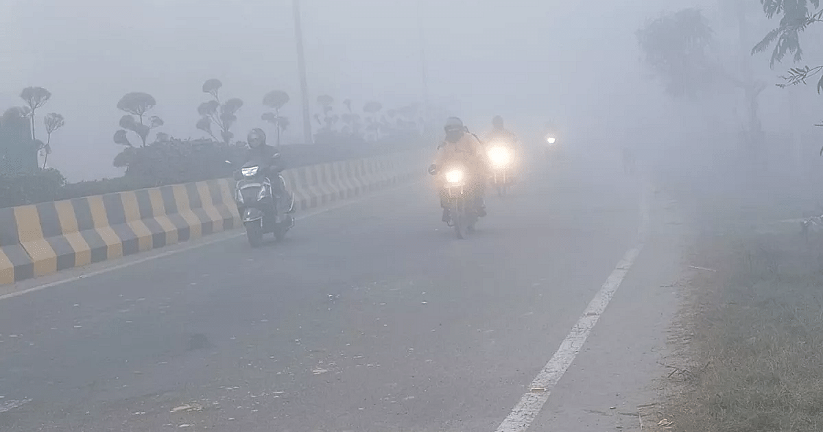
UP Weather Update: After the western disturbance weakens in Uttar Pradesh, now westerly winds will show their strength. Because of this, there are chances of cold getting stronger in the coming days. However, we will have to wait a little for this. At present, cold conditions will be seen in the morning and late night. At the same time, moisture is still present in the ground due to rain, hailstorm and storm due to western disturbance, due to this the moisture of the earth will rise in the form of steam and fog will show its effect in the morning and evening. There will be light sunshine during the day. According to the Zonal Meteorological Centre, Lucknow, due to the active Western Disturbance, there was rain in Uttar Pradesh including the neighboring state of Uttarakhand and other parts of the country. The effect of snowfall in Uttarakhand was also seen in UP. Due to this, a drop in temperature was recorded and due to the cold wind blowing, people got relief from the heat. There will be a gradual decline in temperature in the coming days. By the end of this month the effects of winter will become visible.
Humidity had increased after the return of monsoon
According to meteorologists, due to thunderstorm and rain, the maximum temperature in Lucknow dropped by 5 degrees. The minimum temperature also remained below normal. Earlier, after the return of monsoon, the humidity was showing its effect along with bright sunshine during the day. Now after the rain the situation is like pink cold. According to meteorologists, after the withdrawal of monsoon, due to sunlight and humidity, the earth’s layer was not able to cool down even though the night temperature was low. In such a situation, the rain proved to be a relief. Because of this the weather changed completely and now there is a pink winter situation.
Chance of dry weather till October 22
According to Zonal Meteorological Centre, Lucknow, the weather in Uttar Pradesh will remain generally dry on Wednesday and there is no situation to issue any kind of warning. After this, similar weather will prevail in the state on 19, 20, 21, 22 and 23 October. According to meteorologists, after the decline in maximum temperature, it may gradually increase by three to 6 degrees Celsius. At the same time, the minimum temperature is likely to increase gradually by 3 to 6 degrees Celsius during the next four days.
Conditions are now favorable for the return of monsoon
According to the Zonal Meteorological Centre, Lucknow, if we talk about the weather system in the country, during the next 24 hours, remaining parts of Bihar, Sub-Himalayan West Bengal, Sikkim, entire Northeast India, some more parts of Andhra Pradesh, Telangana, some more parts of North Conditions are now favorable for withdrawal of monsoon from parts and central Bay of Bengal. Western Disturbance is over Jammu region and adjoining parts of Pakistan. The induced cyclonic circulation is over Haryana and surrounding areas.
According to meteorologists, a cyclonic circulation extends up to 3.1 km above the average level over the south-east Arabian Sea and the adjacent Lakshadweep area. Under its influence, a low pressure area is likely to develop over the southeast and adjoining east central Arabian Sea during the next 24 hours. It is likely to move west-northwestwards and intensify into a depression over the central Arabian Sea by October 21.