
Monsoon 2023: In summer, when the Sun is directly above the equator in the Indian Ocean, the monsoon is formed. In this process, the surface of the sea starts heating up and its temperature reaches 30 degrees. During this, the temperature of the earth has reached 45-46 degrees. In such a situation, monsoon winds become active in the southern part of the Indian Ocean. These winds cross each other and cross the equator and start moving towards Asia.
During this time, the process of formation of clouds over the sea starts. After crossing the equator, these winds and clouds turn towards Bay of Bengal and Arabian Sea while raining. During this time the temperature of all parts of the country exceeds the sea level temperature. In such a situation, the winds start blowing from the sea towards the surface. These winds absorb the water vapor produced by the evaporation of sea water and as soon as they reach the earth, they start rising upwards and move forward while raining.
After reaching the Bay of Bengal and the Arabian Sea, these monsoon winds divide into two branches. One branch moves ahead from the Arabian Sea via Mumbai, Gujarat and Rajasthan, while the other branch from the Bay of Bengal collides with the Himalayas via West Bengal, Bihar, Northeast and turns towards the Gangetic regions. In this way, by the first week of July, the whole country starts receiving heavy rains.
When is monsoon declared
The arrival of monsoon will be declared in eastern and northeastern states only when at least 2.5 mm of rain has been recorded in two days. The effect of western wind should be negligible. Low level clouds should have prominence.
what is pre monsoon
Pre-monsoon in Jharkhand refers to the rains from March to the first week of June. During this it rains with thunder. Due to the heat of the sun, the hot air rises upwards in the atmosphere and becomes thunder clouds. During this, there is heavy rain with thunder at some places. It is not necessary that it rains in the entire district.
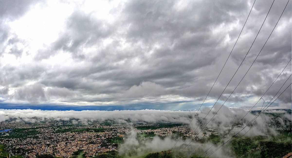
Monsoon arrives in Jharkhand around June 15
Monsoon usually arrives in Kerala on June 1. It reaches Jharkhand in 12 to 15 days. Generally it enters Jharkhand via Santal or Kolhan. After entering Jharkhand, it takes four to five days to spread under normal conditions. Its return starts from the second week of October.
What factors affect the monsoon
al Nino : According to meteorologists, if there is a sudden warming of the sea surface around the equator near South America, especially on the coast of Peru in the Pacific Ocean, then the condition of El-Nino is formed. If this increase in temperature is between 0.5 degree to 2.5 degree then it can affect the monsoon. Due to this, the air pressure starts decreasing in the Central and Eastern Pacific Ocean. The effect of this would be that the winds running around the equator begin to weaken.
La-Nina : In the Peruvian region of the Pacific Ocean, sometimes the surface of the sea starts getting cold. In such a situation, the exact opposite of El-Nino happens. Which is called La-Nina. Due to the formation of La-Nina, the pressure of the air increases and the trade winds gain speed. It has a good effect on the Indian monsoon. In the year 2009, due to the effect of El-Nino on the monsoon, there was less rainfall, while in the year 2010 and 2011, there was good rainfall due to the effect of La-Nina.
Indian Ocean Dipole : During the Indian Ocean Dipole, the western part of the Indian Ocean becomes warmer or colder than the eastern part. Warming of the western Indian Ocean has a positive effect on India’s monsoon, while cooling has a negative effect.
Maiden Julian Oscillation : Due to this, both the strength and duration of monsoon are affected. As a result, the number and intensity of tropical cyclones in the ocean basins are also affected. As a result of which there is a change in the jet stream. It also contributes to the development of the intensity and speed of El-Nino and La-Nina with respect to the Indian monsoon.
Cyclone formation : Extremely low pressure conditions are found in the center of cyclones. Because of which the winds around it flow towards its center at a rapid speed. When such conditions develop near the surface, they positively affect the monsoon. The cyclones formed in the Arabian Sea are more effective than the cyclones in the Bay of Bengal because the entry of the Indian monsoon is towards the Arabian Sea in the peninsular regions.
jet stream Jet streams are fast moving winds above the earth, they directly affect the Indian monsoon.
Potential benefits of a normal monsoon
-
increase in food production
-
water shortage will go away
-
power crisis will reduce
-
heat recovery
10 year rainfall status in Jharkhand (in mm)
Year – Rainfall – Normal
2013 – 844.9-1091.9
2014 – 930.3-1091.9
2015-941.9-1091.9
2016-1101.8-1091.9
2017-988.1-1091.9
2018-785-1091.9
2019-858.9-1054.7
2020-902.4-1054.7
2021-1041.5-1054.7
2022-817.6-1022.9
Coming and going of monsoon in Jharkhand
years come and go
2012 – June 19 – October 15
2014- June 18-October 19
2015 – June 18 – October 17
2016 – June 17 – October 19
2017 – June 16 – October 17
2018- June 25- October 5
2019- June 21- October 14
2020 – June 13 – October 26
2021 – June 12 – October 11
2022 – June 18 – October 20